
Top Stories
Las Vegas Prepares for Freeze After Tropical Storm Priscilla’s Impact

The National Weather Service (NWS) in Las Vegas has issued an update regarding significant weather changes affecting the area. Following the expiration of a Freeze Warning for the Dyer, NV region this morning, residents can expect a brief reprieve as temperatures are forecasted to rise slightly above average by midweek. However, the arrival of Tropical Storm Priscilla may bring unsettled weather conditions later this week.
According to the NWS’s Area Forecast Discussion, the weather is anticipated to remain “quiet” for most of the week due to a transition from an upper-level trough to ridging. This change will lead to warmer temperatures for a short period. Yet, as Tropical Storm Priscilla strengthens south of Cabo San Lucas, its moisture could interact with the upper trough, potentially introducing rain to the Desert Southwest by late in the week or over the weekend.
Forecast models currently present varying predictions, resulting in low certainty regarding the specific impacts of the storm. Nevertheless, the NWS assures that Visual Flight Rules (VFR) conditions are likely to prevail across the region, benefiting both pilots and travelers.
At Harry Reid International Airport, northerly winds are expected to follow sunrise, shifting to a northeast direction later in the morning. Wind speeds are projected to be around 8 knots, with occasional gusts exceeding 10 knots. As daylight fades, winds will shift back to a southwesterly direction. Similar forecasts apply to broader southern Nevada, northwest Arizona, and southeast California, with predicted gusts not exceeding 20 knots.
The NWS highlights a mix of local wind patterns, including Owens Valley’s upvalley breeze and Barstow’s typical westerly winds. Under the prevailing VFR conditions, the clear skies offer a sense of normalcy in the region.
Despite the current calm, the presence of Tropical Storm Priscilla serves as a reminder that weather patterns can change rapidly. Spotters are encouraged to report any significant developments as part of standard safety procedures. As the situation evolves, residents and travelers alike will be closely monitoring updates from the National Weather Service.

Remembering Nancy M Zahorsky: A Life of Dedication and Service

Community Leaders Address Local Issues and Political Controversies

Yale’s School of the Environment Launches New One-Year Master’s Programs

War Lord Aims for Consecutive Wins at Plumpton on Monday

South Korean Shipbuilders Offer Solutions for US Navy Crisis

Trump Administration Launches Inquiry into ‘No Kings’ Protests

Orchard Park Hosts Successful Pepper Palooza to Benefit Charities

Palmer Luckey Outlines ‘China 27’ Strategy Amid Taiwan Tensions
WVU Researchers Harness AI to Transform Heart Disease Diagnosis in Rural Areas

Libraries Challenge Rising E-Book Costs Amid Growing Demand

Tyreek Hill Responds to Tua Tagovailoa’s Comments on Team Dynamics

Liverpool Secures Agreement to Sign Young Striker Will Wright

Save Your Split Tomatoes: Expert Tips for Gardeners

Princess Beatrice’s Daughter Athena Joins Siblings at London Parade

Winter Storms Lash New South Wales with Snow, Flood Risks

Trump Administration Moves to Repeal Key Climate Regulation

SoFi Technologies Shares Slip 2% Following Insider Stock Sale

San Francisco Hosts Unique Contest to Identify “Performative Males”
-
 Lifestyle3 months ago
Libraries Challenge Rising E-Book Costs Amid Growing Demand
-
 Sports3 months ago
Tyreek Hill Responds to Tua Tagovailoa’s Comments on Team Dynamics
-
 Sports3 months ago
Liverpool Secures Agreement to Sign Young Striker Will Wright
-
 Lifestyle3 months ago
Save Your Split Tomatoes: Expert Tips for Gardeners
-
 Lifestyle3 months ago
Princess Beatrice’s Daughter Athena Joins Siblings at London Parade
-
 World3 months ago
Winter Storms Lash New South Wales with Snow, Flood Risks
-
 Science3 months ago
Trump Administration Moves to Repeal Key Climate Regulation
-
 Business3 months ago
SoFi Technologies Shares Slip 2% Following Insider Stock Sale
-
 Science2 months ago
San Francisco Hosts Unique Contest to Identify “Performative Males”
-

 Science3 months ago
New Tool Reveals Link Between Horse Coat Condition and Parasites
-
 Sports3 months ago
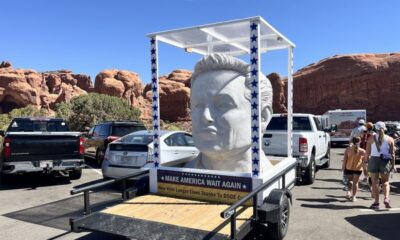
Elon Musk Sculpture Travels From Utah to Yosemite National Park
-

 Science3 months ago
New Study Confirms Humans Transported Stonehenge Bluestones